


Pergezime per temen! Di qe disa nga hartat etnologjike jane hartuar nga Shoqerite Gjeografike te vendeve te ndryshme te Europes ne fund te Shek. te 19te-fillim Shek te 20te.
Por per shume prej tyre mungon burimi fillestar dhe viti i botimit. Do te ishte mire qe keto info te shtoheshin ne postimet perkatese, nqs jane te disponueshme!
FLUCTUAT NEC MERGITUR
.............................
"Uberlicht von Europa mit Ethnograph ..." (Ethnographic map of Europe)
published in Dr. Heinrich Berghaus' Physikalischer Atlas, Gotha, 1855 (map dated 1855.)
Fine steel engraved map with original hand colour, coded to the key upper left. Size 42 x 31.5 cms.

Map from "Report of the International Commission To Inquire into the Causes and Conduct of the Balkan Wars" 1914. [This map shows areas occupied by Balkan armies at the end of April 1913: (Serbian, Montenegrin, Bulgarian, Greek)]. "War began with the declaration of Montenegro on 8 October [1912], and, within a few months, to the amazement of Europe, the Turkish forces had collapsed."--quote from: Great Britain. Naval Intelligence Division, Geographical Handbook Series: Yugoslavia, Volume II, 1944, p. 114.

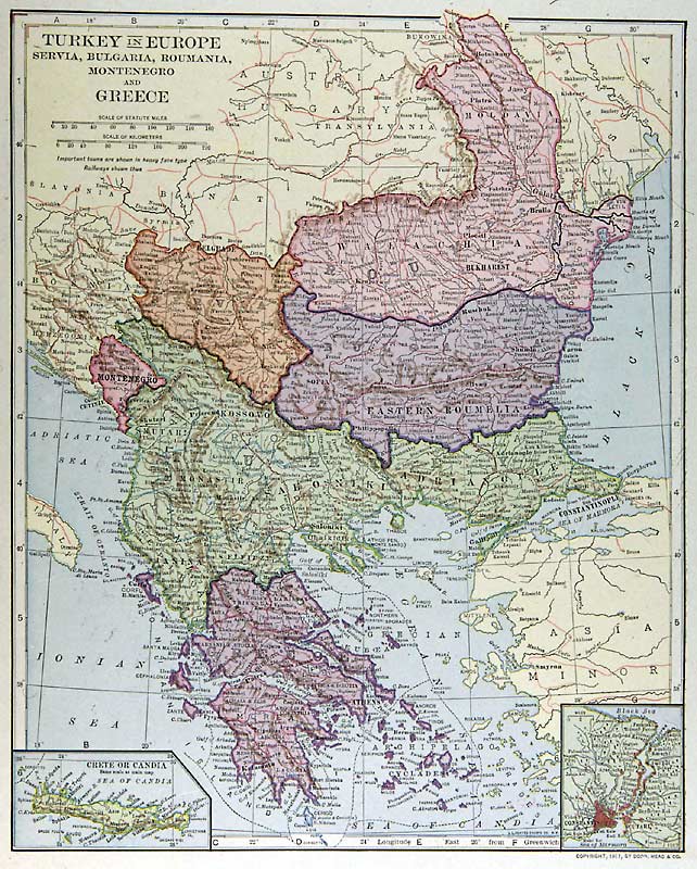
"Turkey in Europe" (with Greece, Bulgaria, Macedonia, Albania &c.)
drawn and engraved by John Archer, published in The National Encyclopedia Atlas, 1868.
Lithographic map with full original hand colouring. Size 29 x 23 cms plus margins.

E DUA SHQIPERIN SA ISHTE PA ASNJE COP NE DUART E UQVE BASHKIM BASHKIM SA ME SHPEJT PER NJE SHQIPERI TE VERTET DHE TE MADHE
BORSHI NE EMIGRIM A lleshi
 Regullat e Postimit


 Përgjigju Duke Cituar
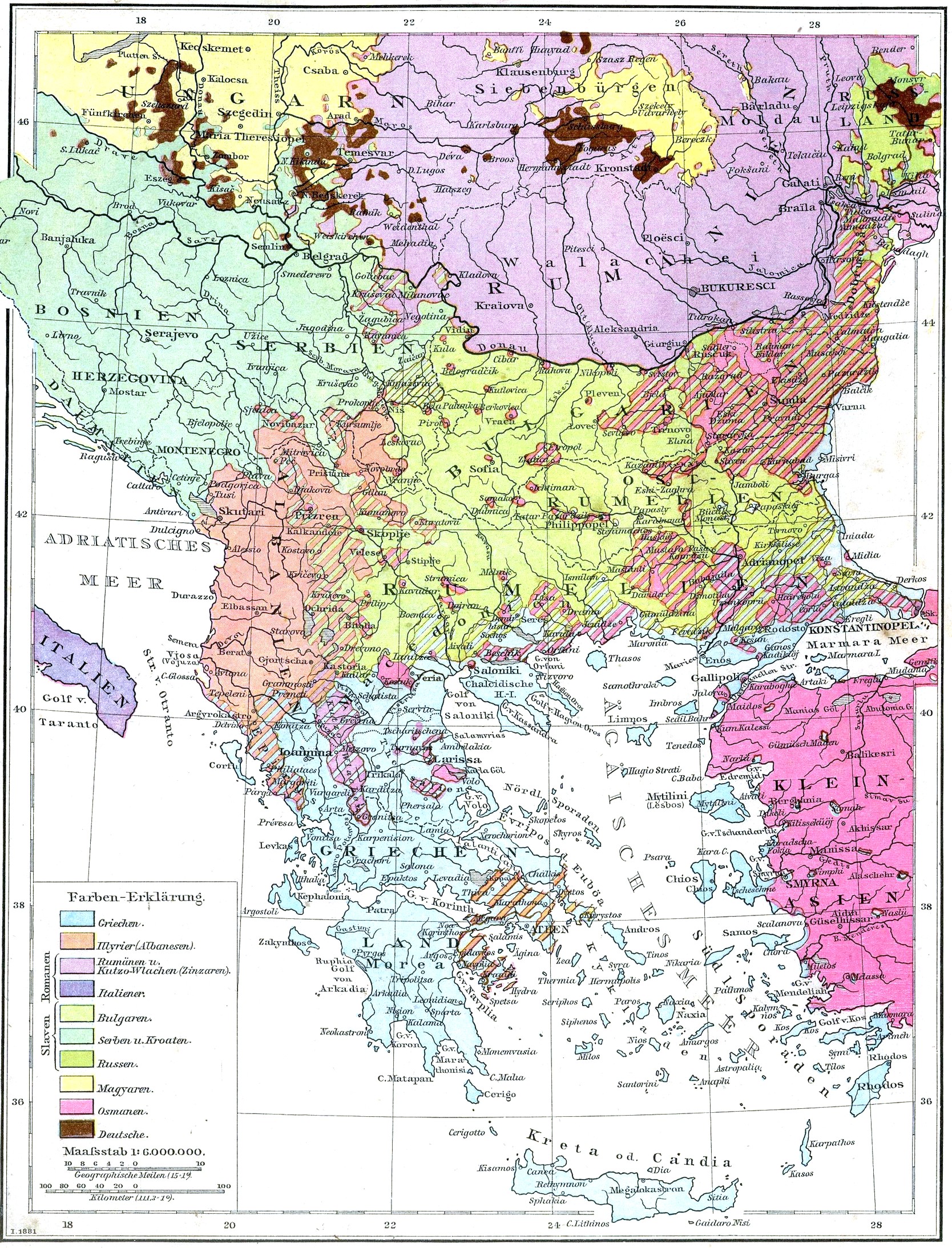

Krijoni Kontakt