
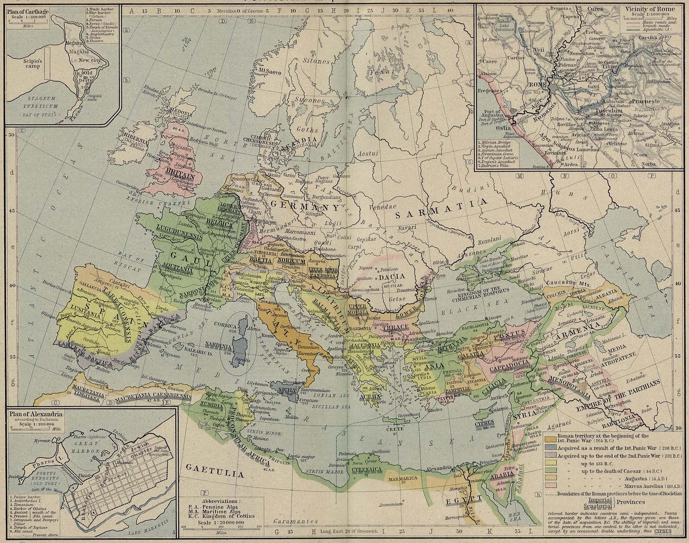
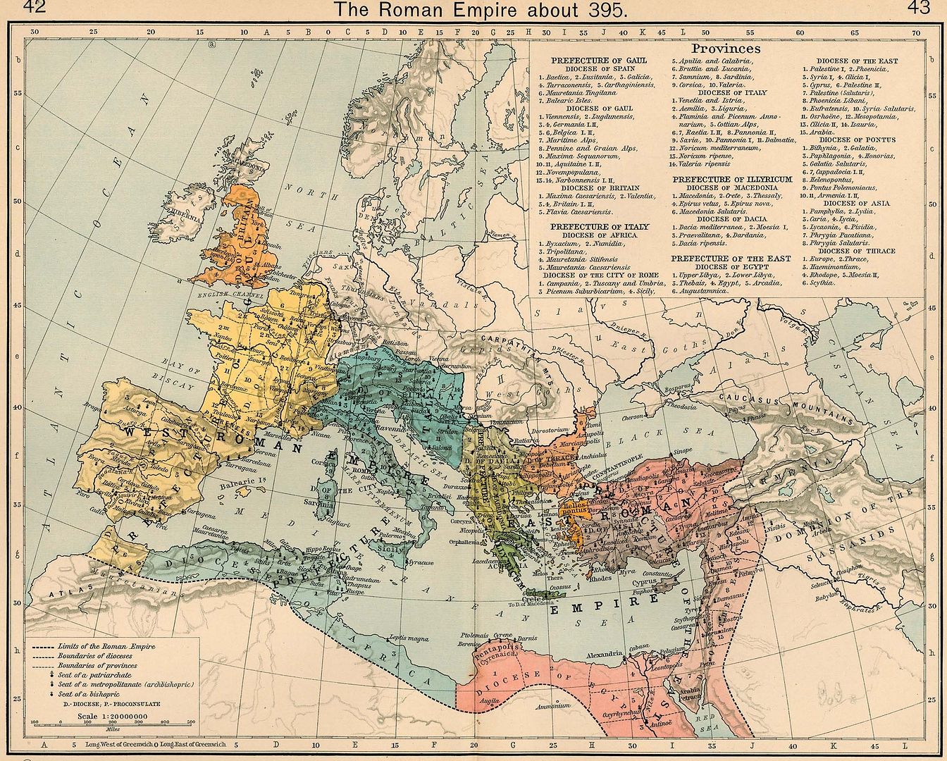
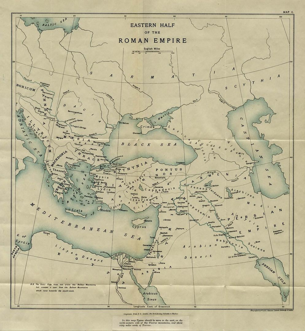
Harte e vjeter e perandorise romake,rreth vitit 395.
Shiqoni mire deri ku shtrihej "Prefecture of Illyricum".
Deri ne Krete.
Shtrirja e Ilirise ne vitin 218 B.C.


Harte e vjeter e perandorise romake,rreth vitit 395.
Shiqoni mire deri ku shtrihej "Prefecture of Illyricum".
Deri ne Krete.
Shtrirja e Ilirise ne vitin 218 B.C.
Hartë etnike e Ilirisë
Nje "pershendetje" per sllavet e jugut qe ne kete kohe ishin ne Siberi.
vazhdon.........
Ja edhe nje harte deri ku mberrine emri i shkruar Illyric---deri ne Krete
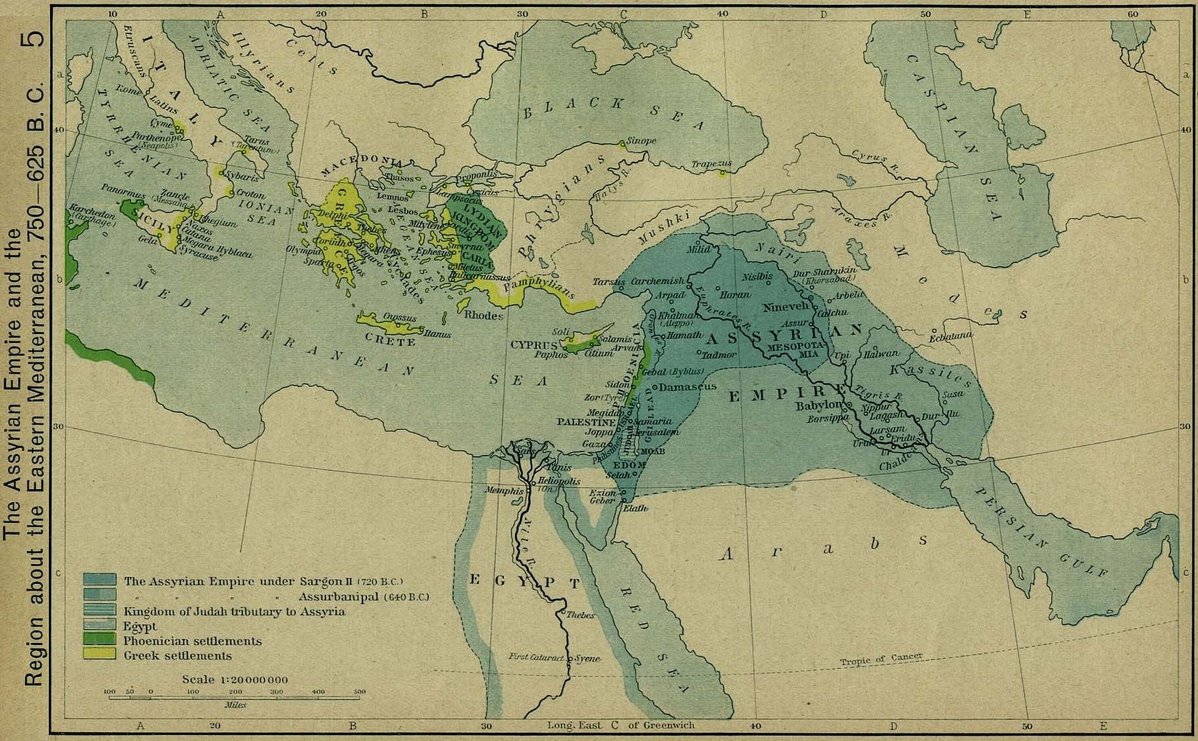
Viti 760-625 B.C.
Perandoria asire,ku shihen edhe trojet ilire.
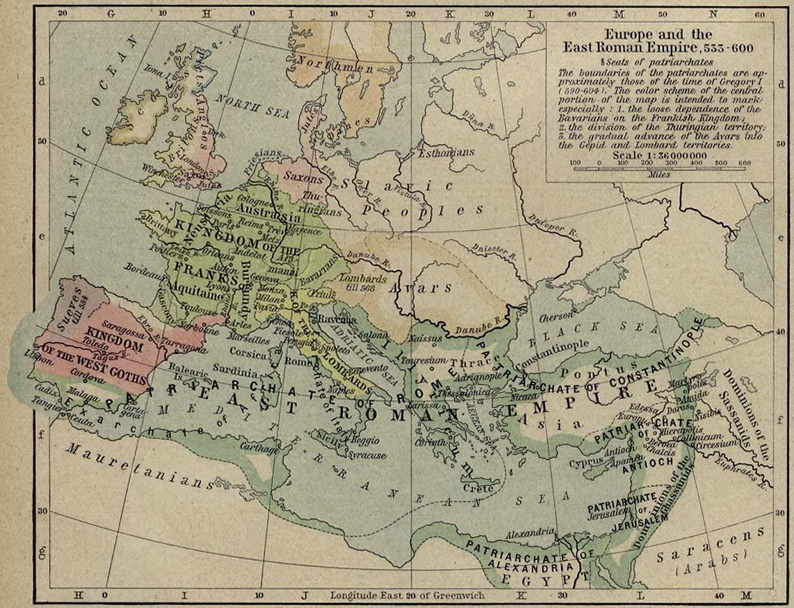
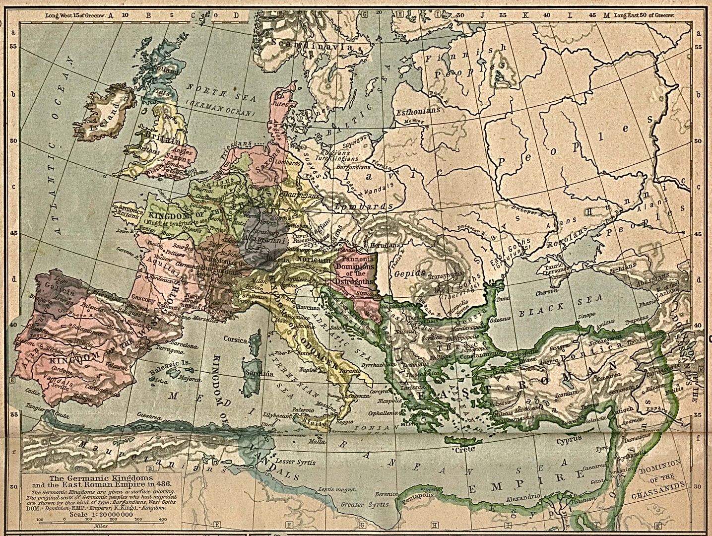
Harte e vitit 533-600 e perandorise romake ku shihet edhe shtrirja e territoreve ilire
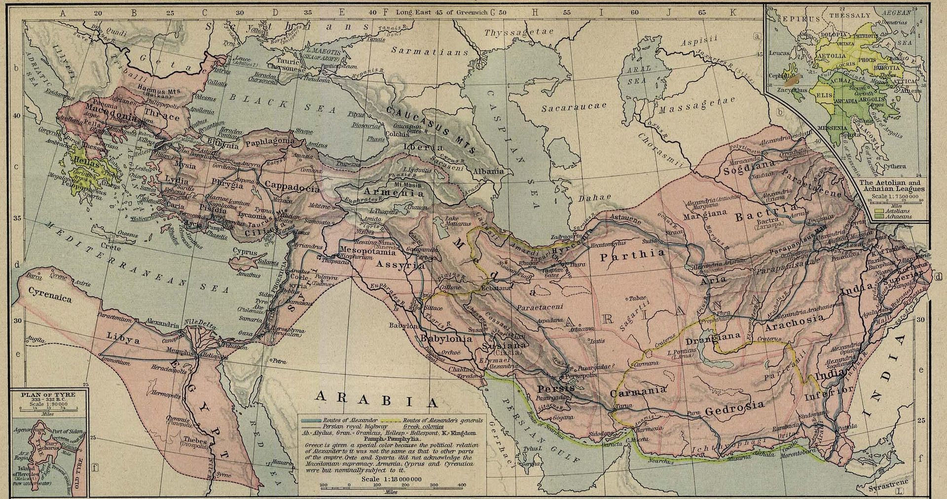
viti 336-323 B.C.E.
Shtrirja e Ilirise ne pjesen me te madhe te ballkanit dhe pergjate tere detit Adriatik.Kjo harte dhe shume tjera ju mbyllin gojen sllaveve dhe aleateve te tyre.
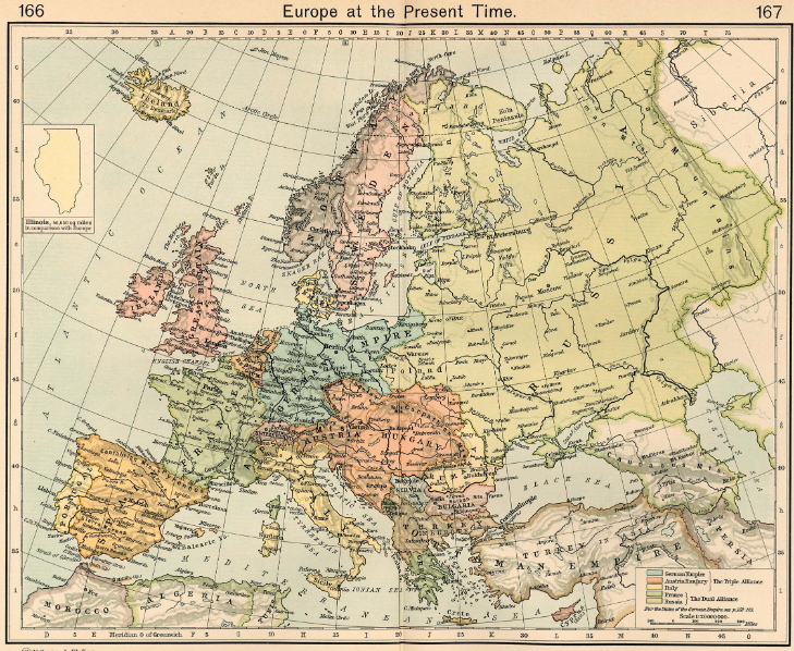
Nderkaq ketu me poshte eshte nje harte e vitit 1911,pra nje vit para shpalljes se pavaresise se Shqiperise.
Po e sjelli koleksionin komplet qe posedoj.Kur shikon disa harta te mevonshme sidomos pas ardhjes se sllaveve ne trojet ilirike me te vertete te bejne te ndjehesh keq.
Sidoqofte,jane harta historike qe deshmojne histori.
P.S.Moderatoret nese e shohin te nevojshme le ti vendosin edhe keshtu,une po i ve vetem me link.
http://i932.photobucket.com/albums/a...th_Century.png
http://i932.photobucket.com/albums/a...pe_in_1560.png
http://i932.photobucket.com/albums/a...pe_in_1740.png
http://i932.photobucket.com/albums/a...pe_in_1401.png
http://i932.photobucket.com/albums/a...ks_in_1355.png
http://i932.photobucket.com/albums/a...81_to_1683.png
http://i932.photobucket.com/albums/a...empire_450.jpg
http://i932.photobucket.com/albums/a..._1801_1812.jpg
http://i932.photobucket.com/albums/a...iddle_ages.jpg
http://i932.photobucket.com/albums/a...pire450BCE.jpg
http://i932.photobucket.com/albums/a...oples900CE.jpg
http://i932.photobucket.com/albums/a...pe_in_1360.png
http://i932.photobucket.com/albums/a..._1672_1699.jpg
http://i932.photobucket.com/albums/a...ngdoms_526.jpg
-------------------------------
http://i932.photobucket.com/albums/a...s_150_1066.jpg
http://i932.photobucket.com/albums/a...greece_362.jpg
http://i932.photobucket.com/albums/a...n_ref_1926.jpg
http://i932.photobucket.com/albums/a...op_war_431.jpg
http://i932.photobucket.com/albums/a...ar_500_479.jpg
http://i932.photobucket.com/albums/a...nician_550.jpg
http://i932.photobucket.com/albums/a...anean_1204.jpg
http://i932.photobucket.com/albums/a...memberment.jpg
http://i932.photobucket.com/albums/a..._1481-1683.jpg
http://i932.photobucket.com/albums/a...mpires_814.jpg
http://i932.photobucket.com/albums/a...mpire_1265.jpg
http://i932.photobucket.com/albums/a...mpire_1355.jpg
http://i932.photobucket.com/albums/a...lifate_750.jpg
http://i932.photobucket.com/albums/a...y_dev_1300.jpg
http://i932.photobucket.com/albums/a...urope_1560.jpg
http://i932.photobucket.com/albums/a...urope_1740.jpg
http://i932.photobucket.com/albums/a..._1871_1914.jpg
http://i932.photobucket.com/albums/a...urope_1911.jpg
http://i932.photobucket.com/albums/a...urope_1924.jpg
http://i932.photobucket.com/albums/a...ne_empires.jpg
http://i932.photobucket.com/albums/a...l_commerce.jpg
http://i932.photobucket.com/albums/a...anean_1097.jpg
http://i932.photobucket.com/albums/a...anean_1190.jpg
http://i932.photobucket.com/albums/a...ist_greece.jpg
Harte e vitit 1861
http://i50.tinypic.com/2egf8fc.jpg
linku me zmadhime.2 here.Illyrer(Albanese).
http://img35.imageshack.us/img35/1823/skanna0001a.jpg
nga libri Historia Botrore II-1917
EUROPA
Linku me zmahim
.http://img338.imageshack.us/img338/92/skanna0073.jpg
Eurostar1 ke te drejte per ato qe thua.Kam pare ne Budva tek kalaja kishte brenda nje bibloteke dhe harta te vjetra.Nder te shumta kishte dhe nje te ballkanit ku shkruhej iliriada.Kufiri jugor shtrihej deri ne gjysmen e Greqise,Maqedonia nuk egzistonte fare Mali i Zi ishte i pergjysemuar dhe kufiri verior e kalonte Nishin dhe shkonte afer Kragujevacit Te krijonte nje emocion te madh.
Ka qene dhe me e madhePostuar më parë nga ^_BIM_BUM_BAM_^

 Regullat e Postimit


 Përgjigju Duke Cituar

Krijoni Kontakt